wildlife-drone-maneuver
A Maneuver-Indexed Testbed for Context-Aware Adaptive Wildlife Drones
A replayable, labeled testbed for evaluating self-adaptive wildlife-drone flight policies.





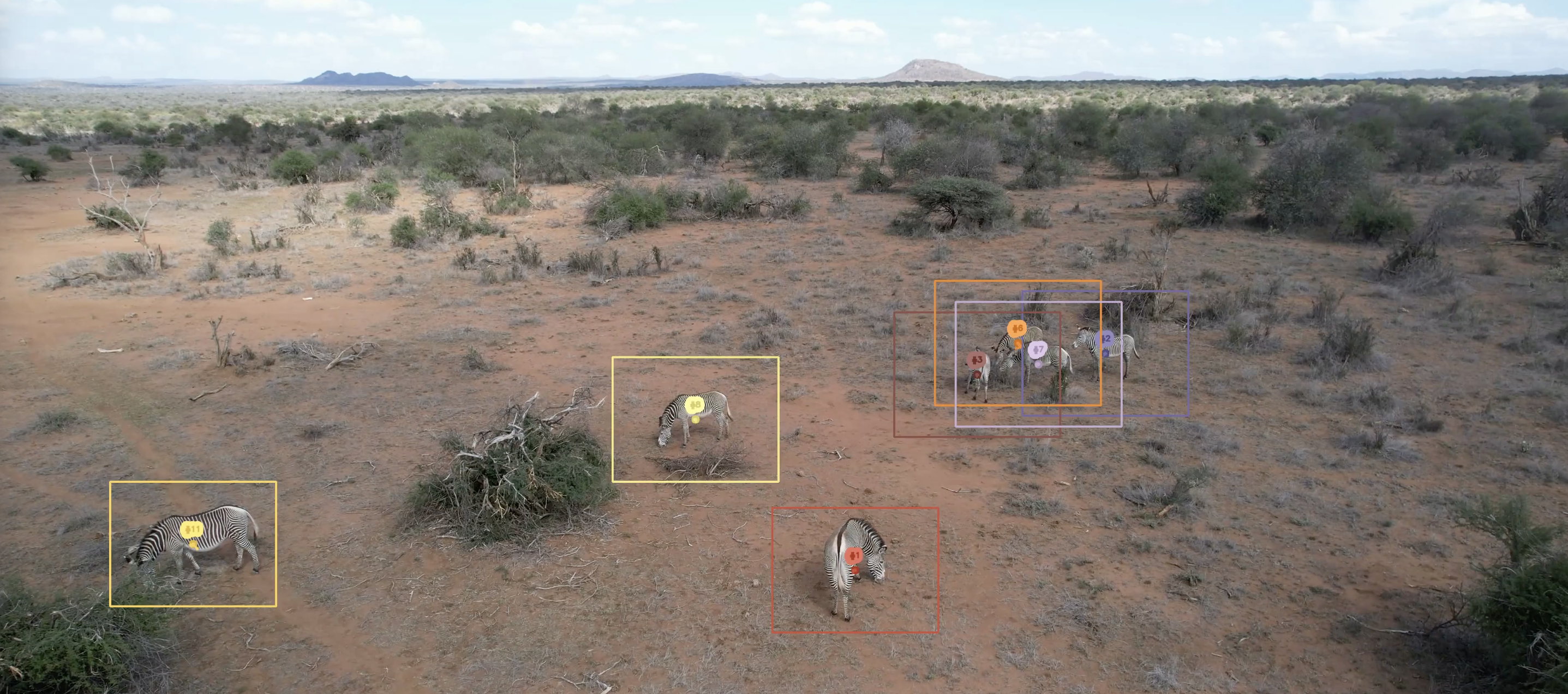
Example frame from KABR with its per-frame ground-truth boxes showing a herd of Grevy's zebras.
Using the labeled frame as input, the maneuver evaluation framework replays the decision tree to produce the reference drone actions.
Project Overview and Impact
Autonomous drones are transforming wildlife monitoring, but the perception pipelines that analyze their video are run almost entirely offline. Moving computer vision models out of the cluster and into the field would allow drone systems to run inference in real-time with edge AI. Integrating edge AI into the drone’s control loop enables self-adaptive flight, in which drones adjust their trajectory in real time to optimize data collection. Instead of wasting precious resources collecting data unusuable for the desired downstream analysis, self-adaptive drones can automatically adjust keep a herd in frame, capture a required viewpoint, or back off when animals show disturbance. Studying self-adaptive flight requires a replayable, labeled, multi-session testbed, which we provide with this artifact.
For the initial release, we use raw drone videos from the Kenyan Animal Behavior Recognition Dataset (KABR zebras and giraffes at Mpala Research Centre, Kenya). However, this framework is designed to be additive so that other settings and species may be added to the collection. To enable this, video clips are indexed against the FAIR² Drones standard, which provides unified platform, autonomy, and ecological metadata across drone datasets. Because every clip resolves through FAIR² event IDs rather than dataset-specific paths, new sites and species can be folded into the same benchmark without restructuring, allowing the testbed grow across the community’s drone datasets.
Artifact Components
| Component | What it is | Where |
|---|---|---|
| Dataset | 41 six-second aerial clips with per-frame-per-track labels (bounding box (bbox), species, behavior, vigilance, track id, GT pose where available, telemetry) + per-frame ground-truth maneuver actions. | imageomics/drone-maneuver-clips |
| Interactive demo | A zero-install Gradio app: filter clips, tune the maneuver decision tree live, and score a navigation policy — all CPU-only, in the browser. | imageomics/drone-maneuver-demo |
| This repository | The clip-library build pipeline, the deterministic maneuver evaluation framework, and the formal decision-tree specification. | you are here |
Where the maneuvers apply
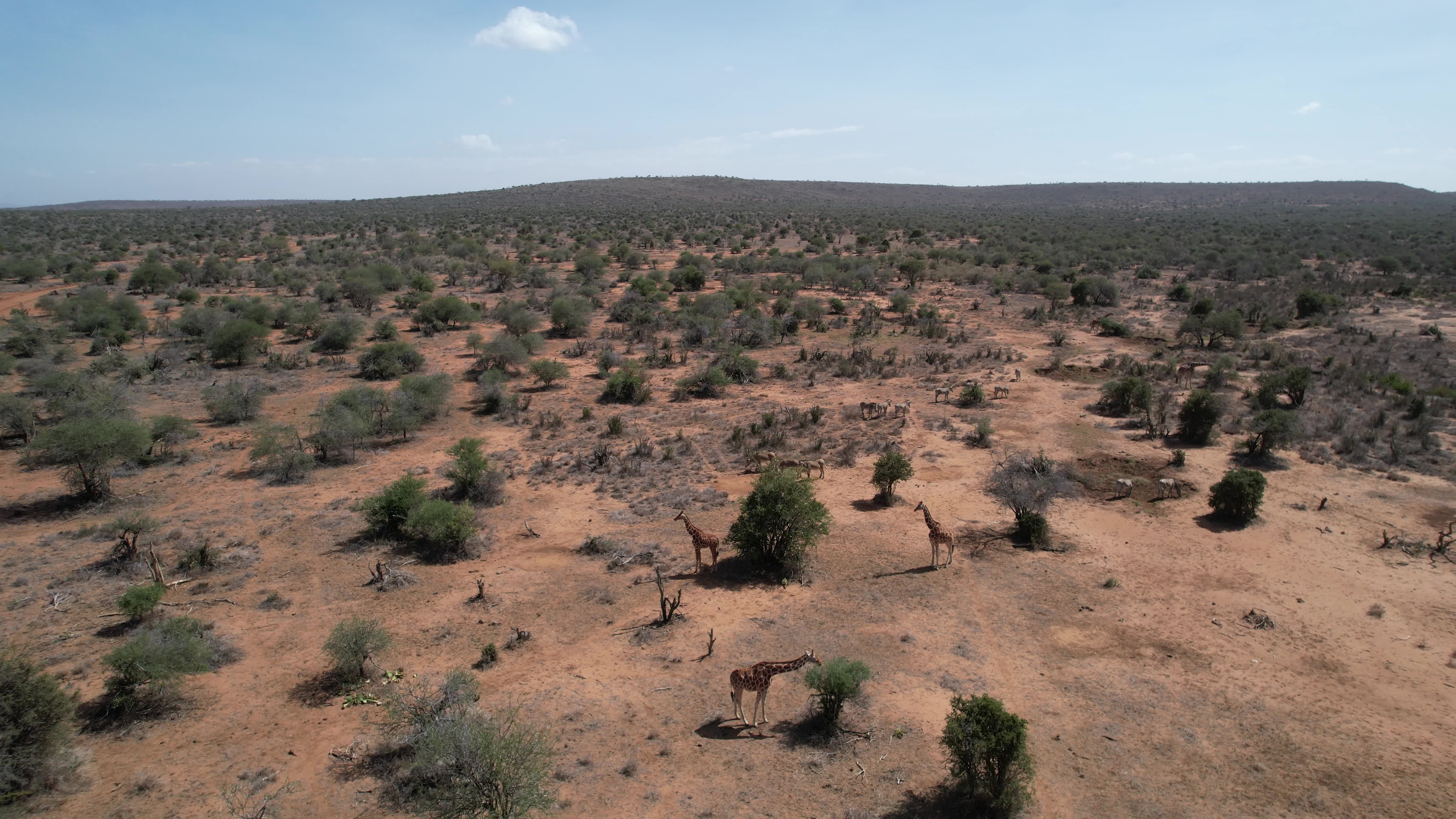 TRACK / SoI-aware Mixed (bushy) habitat — the herd centroid drifts behind cover; TRACK recenters it and SoI-aware yaws for a clear viewpoint. |
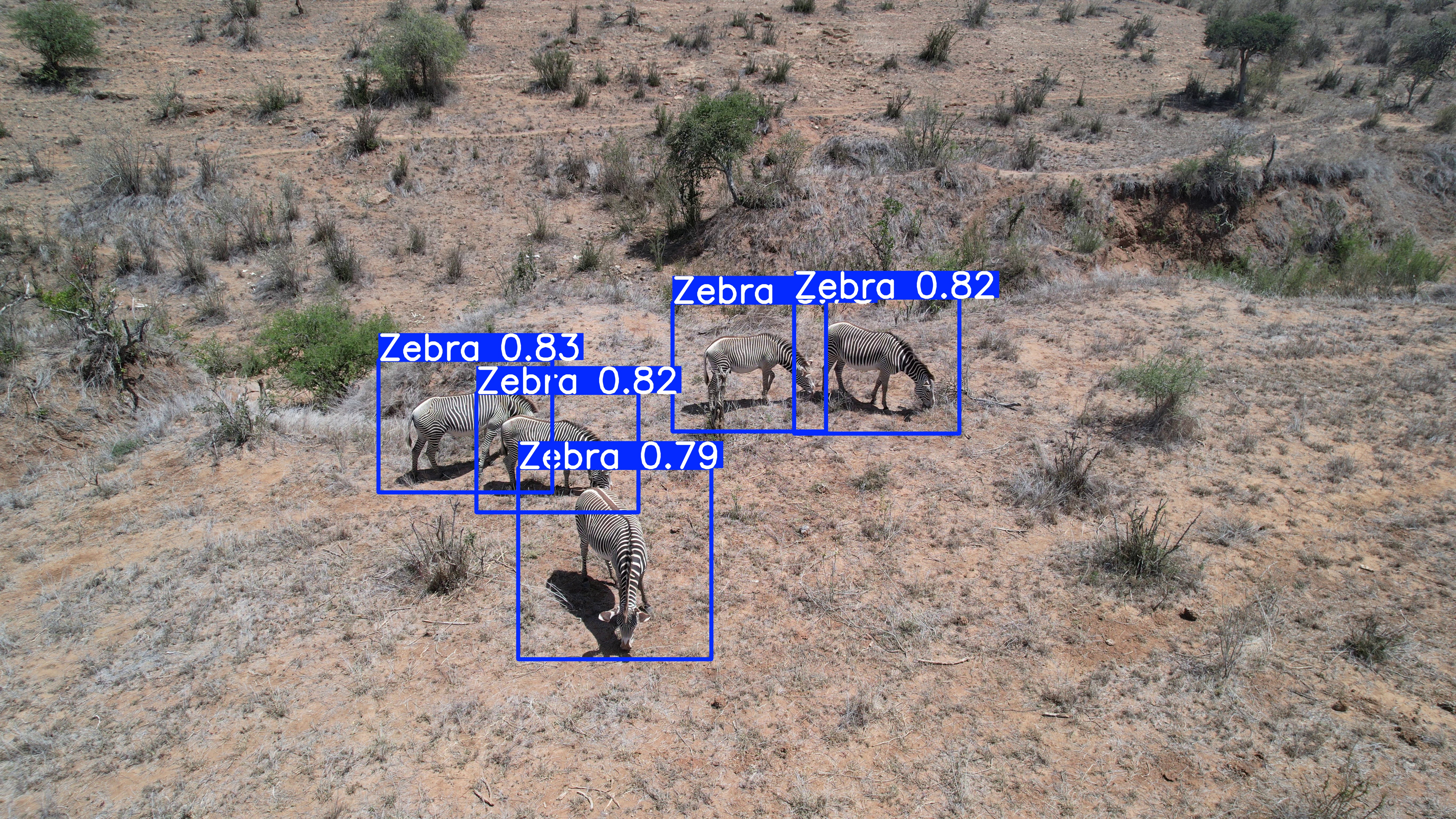 SoI-aware / re-ID Grevy's zebra — capturing the broadside Surface-of-Interest with sufficient pixel granularity is what makes individual re-ID possible. |
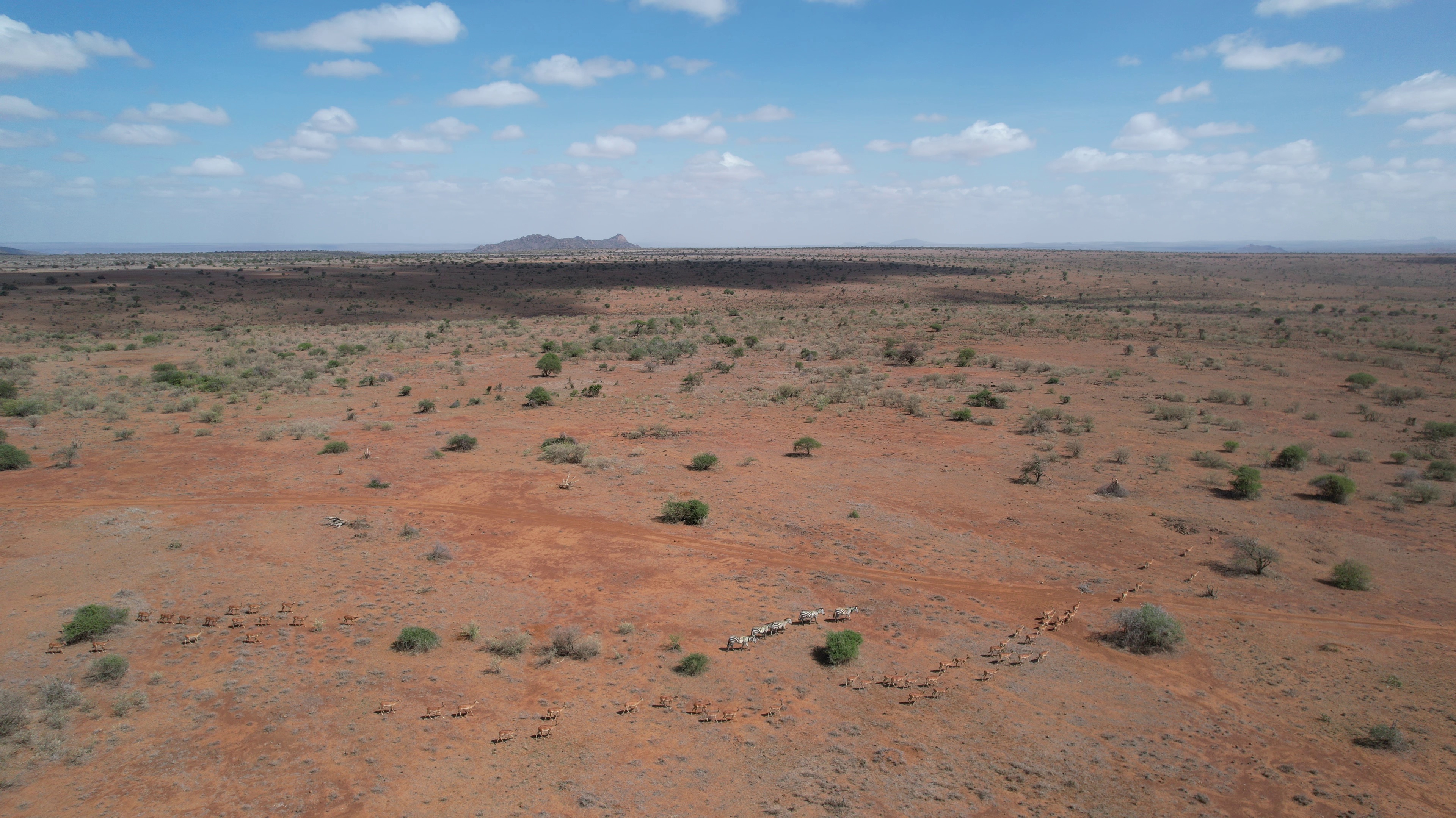 APPROACH / TRACK Open habitat, large dispersed herd — APPROACH descends to the detected group, then TRACK holds the centroid in the center-50% keep-zone. |
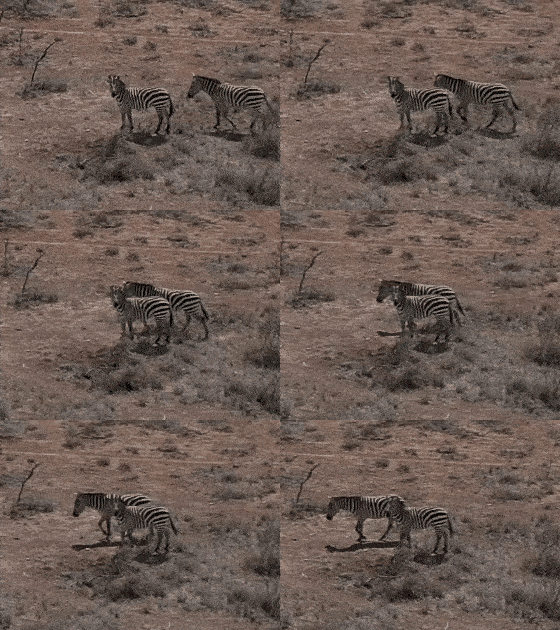
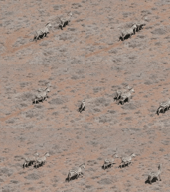
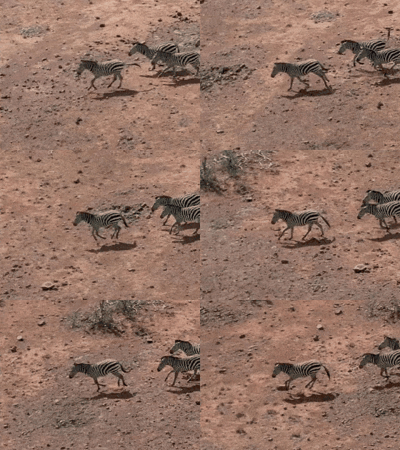 BEHAVIOR-ADAPTIVE FLIGHT (BAF) — head-up, trotting, running Head-up, trotting, and running are the vigilance behaviors; when smoothed vigilance rises above threshold, BAF overrides the active maneuver and the drone halts or backs off, depending on user setting. |
See
clip_library/maneuver_decision_tree.mdfor the exact rule each maneuver follows.
Quick start
📺 New here? Watch the video tutorial for a guided walkthrough of the artifact and the interactive demo.
Option A — Hugging Face Space (recommended, zero-install)
Open the live demo. With no install you can: browse and filter the clip catalog, play a clip, tune the decision-tree thresholds and re-run the evaluation framework live, score baseline (or your own) policies against the reference, and run the full-benchmark timing + reproducibility hash. This is the fastest way to understand what the artifact does.
Option B — Run locally
For programmatic use, batch experiments, or rebuilding the dataset, see Installation and Usage below. The common path (Usage → maneuver replay) needs only the released dataset and is CPU-only.
System & environment requirements
| requirement | |
|---|---|
| OS | Tested on Linux (RHEL 9, x86-64). macOS and Windows are untested but expected to work — the code is pure Python (pandas/numpy, plus OpenCV/pyarrow for the build pipeline) with no OS-specific dependencies; on Windows, WSL2 is the recommended path. No VM/Docker required. |
| Python | 3.9+ (the hosted demo runs 3.12). |
| CPU / GPU | CPU only, no GPU required. |
| RAM | ~2 GB (video frames are decoded one at a time and the CSVs are small). |
| Disk | ~6 GB for the released clip library snapshot. |
| Download | ~6 GB one-time snapshot_download of the dataset (pinned revision); cached thereafter. |
| Network | Needed once to fetch the dataset snapshot; fully offline afterwards. |
| Setup time | < 10 minutes including the dataset download. |
Installation
# 1. Clone
git clone https://github.com/Imageomics/wildlife-drone-maneuver.git
cd wildlife-drone-maneuver

# 2. Environment (a virtualenv or conda env is fine)
python -m venv .venv && source .venv/bin/activate
pip install .                  # Mode A evaluation framework: pandas + numpy (CPU-only)
# pip install ".[pipeline]"    # Mode B as well: adds opencv-python-headless + pyarrow
# (or `pip install -r requirements.txt` for the dependencies without the package)

# 3. Get the data — pinned to the reviewed release revision.
pip install huggingface_hub
python -c "from huggingface_hub import snapshot_download; \
print(snapshot_download('imageomics/drone-maneuver-clips', repo_type='dataset', revision='v1.1-acsos26'))"
The printed path is the dataset root. Point the evaluation framework at it with
export DRONE_CLIPS_ROOT=/path/to/snapshot (or pass --out to the CLI). To rebuild the clips
from raw KABR video instead of downloading them, see
Reproducing the dataset.
Usage
Getting started: load a clip and its labels
import pandas as pd
from huggingface_hub import snapshot_download

root = snapshot_download("imageomics/drone-maneuver-clips",
                         repo_type="dataset", revision="v1.1-acsos26")

catalog = pd.read_csv(f"{root}/catalog/clip_index.csv")
clip_id = catalog.iloc[0]["clip_id"]

labels = pd.read_csv(f"{root}/clips/{clip_id}/labels.csv")     # per-frame-per-track
actions = pd.read_csv(f"{root}/clips/{clip_id}/maneuver_labels.csv")  # GT drone actions
print(clip_id, labels.shape, actions["maneuver"].unique())
print(labels.head())
labels.csv is one row per frame per tracked individual (bbox, species, behavior, vigilance,
pose, telemetry). maneuver_labels.csv is one row per frame per maneuver — the ground-truth
drone action a calibrated controller would take. Full per-column docs are in the
dataset card and
clip_library/schema.py.
Running the maneuver evaluation framework
The evaluation framework replays the formal maneuver decision tree
deterministically over a clip’s labels.csv, emitting the per-frame action set (raw and smoothed),
the triggering branch, and the frame features the decision used.
Python API:
from clip_library.maneuver_labels import generate, Params

# Defaults reproduce the released labels bit-for-bit.
out = generate(f"{root}/clips/{clip_id}/labels.csv", maneuver="track", params=Params())

# A "what-if": stricter vigilance threshold for the disturbance-response maneuver.
out = generate(f"{root}/clips/{clip_id}/labels.csv",
               maneuver="behavior_adaptive", params=Params(theta_S=0.3))
print(out[["frame_local", "action_set_raw", "action_set_smoothed", "triggering_branch"]].head())
Command line:
export DRONE_CLIPS_ROOT=/path/to/snapshot   # dataset root from Installation (or pass --out)

# Generate GT actions for every clip and the maneuvers it's tagged for.
python -m clip_library.maneuver_labels --all

# Tune a single clip / maneuver (writes a *.custom.csv sidecar; never overwrites the release).
python -m clip_library.maneuver_labels --clip 12_01_23-DJI_0002_000745 \
       --maneuver behavior_adaptive --theta-s 0.3
python -m clip_library.maneuver_labels --maneuver soi_aware --soi right --desired-pixels 100
The four maneuvers (approach, track, behavior_adaptive, soi_aware) and every branch are
specified, condition-by-condition, in
clip_library/maneuver_decision_tree.md.
The dataset catalog tags clips with the spec names
launch/follow; the evaluation framework and demo use the branch namesapproach/track(mappinglaunch → approach,follow → track). The other two names are identical in both.
User-tunable parameters
Every parameter below corresponds to a real field failure mode an autonomous wildlife drone must
trade off. They are exposed through Params (Python) and --flags (CLI), and live as sliders in
the demo. With the defaults, the evaluation framework reproduces the released labels exactly.
Param (Params field / CLI) |
Controls | Decision branch it gates | Field failure if mis-set | Default |
|---|---|---|---|---|
desired_pixels / --desired-pixels |
Target apparent animal size (longest bbox side, px) | TRACK & SoI range control (forward/back) | Too small → animal lost / unreliable detection; too large → disturbance | 30 (TRACK) |
pixel_band |
Tolerance threshold around desired_pixels |
Whether range control acts or holds | Too narrow → jitter/oscillation; too wide → sluggish framing | 0.25 |
theta_S / --theta-s |
Vigilance threshold on smoothed signal S_t |
BAF disturbance-response (retreat/hover) override | Too low → drone pauses or retreats constantly; too high → animals may flee | 0.5 |
soi / --soi |
Desired Surface-of-Interest (viewpoint/pose) | SoI-aware yaw repositioning | Wrong viewpoint → data scientifically unusable | left (broadside) |
max_animals |
How many of the largest tracks to follow | Centroid / mean_px aggregation |
Too low → ignores herd; too high → chases outliers across fission/fusion | 5 |
launch_altitude / end_altitude |
Climb/descent envelope (m) | APPROACH altitude branches | Mis-set → approaches at a spooking altitude | 50 / 30 |
baf_response |
Disturbance action set | BAF trigger action | Backing up can worsen disturbance; tune per species | retreat = {back, up} |
desired_pixels
The apparent size of the animal in frame, in pixels (longest bounding-box side). It gates the
approach/back-off range control in TRACK and SoI: below desired_pixels·(1−pixel_band) the drone
moves forward; above desired_pixels·(1+pixel_band) it moves back. Too small and detection
becomes unreliable and individuals are lost; too large and the drone flies close enough to disturb
the animals. SoI presets per downstream objective (Params.with_objective): track 30, behavior
100, re-ID 500 px.
theta_S
The vigilance threshold applied to S_t, the trailing 90-frame (3 s) mean of the per-frame
fraction of vigilant animals (behavior ∈ {Head Up, Running, Trotting}). When S_t ≥ theta_S the
Behavior-Adaptive Flight (BAF) maneuver overrides the active maneuver with the disturbance response.
Set it too low and the drone retreats at the slightest movement (no usable data); too high and it
keeps harassing animals that are already alarmed.
soi (Surface of Interest)
The target viewpoint/pose of the herd majority. The eight poses form a ring
(front → front-right → right → …); the SoI-aware maneuver yaws the short way around the ring to
bring the majority pose to soi, then holds at the target apparent size. The right viewpoint is
what makes downstream science (individual re-ID, behavior scoring) possible — the wrong one renders
otherwise-perfect footage scientifically unusable.
pixel_band
The tolerance threshold for desired_pixels — the zone in which the drone holds
rather than correcting its range. If this is set too narrowly, thehn the drone will oscillates forward/back. If too wide, then the drone will reacts sluggishly to the herd drifting out of the desired size.
A note on smoothing
SMOOTH_WINDOW (3 s = 90 frames @ 30 fps) is a fixed module constant, not a tunable parameter.
Raw per-frame action sets are decomposed onto four signed axes (x, y, z, yaw), averaged over the
trailing window, then re-thresholded (dead-zone |mean| ≤ 0.33) to suppress jitter. It is fixed on
purpose: the smoothed series defines the published reference label. Changing it would alter the
benchmark target itself rather than the policy under test, so it is held constant while the
field-meaningful thresholds above stay tunable.
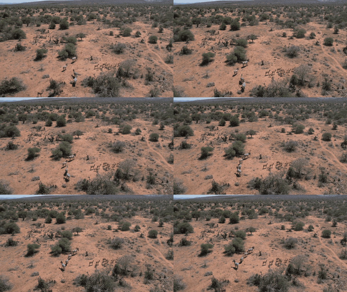
A mixed herd on the move, two female Plain zebras and a Grevy's zebra with her foal with a herd of impala. Example of a multi-animal scene a navigation policy is scored against, frame by frame.
Policy scoring (the intended downstream use)
A learned navigation policy is scored, per maneuver, against the evaluation framework’s ground-truth actions. Scoring is available in the demo’s “Policy scoring” tab.
Input format
A CSV with one row per frame: frame_local,action, where action is one of the 9-action space
(up, down, forward, back, left, right, yaw-left, yaw-right, hover). Baseline policies produce the
same shape internally, so uploaded and built-in policies are scored through an identical path.
Evaluation
The reference for evaluation is the action_set_smoothed column of maneuver_labels.csv for the chosen maneuver — i.e. the published label.
Scoring against the smoothed action provides evaluation against the target a real controller
would track, as the raw set is too jittery to be a useful baseline.
How a match is decided
The reference action set is reduced to its primary action (_first_action: the first token of a
|-joined set, e.g. back|up → back) and compared for equality against the policy’s action on
that frame. Per-frame primary-action match keeps the metric interpretable across the 9-action space
and avoids rewarding partial set overlap. Policies that emit a single action per frame (the common
case) are scored directly.
Metrics reported
- Overall action accuracy — fraction of jointly-covered frames where the policy action equals the reference primary action.
- Per-action accuracy — accuracy broken down by the reference action, so a policy that only ever
predicts
hoveris exposed (high on hover frames, zero elsewhere). - Confusion matrix over the full 9-action space.
- Frame coverage — scoring is an inner join on
frame_local, so only frames present in both the policy and the reference are counted (reported as the number of frames scored).
Baselines
We provide three reference policies scored through the identical path, so the comparison is fair:
| Baseline | Behavior |
|---|---|
random |
Uniform random action per frame (seeded). |
always-hover |
hover every frame which is the trivial “do nothing” floor. |
greedy-centroid |
Steer toward the herd centroid: left/right/forward from the mean x_c. A minimal worked policy. |
Worked example
In the demo: select a clip in Clip explorer, open Policy scoring, choose maneuver track
and baseline greedy-centroid, and click Score. You should see an overall accuracy, a
per-action breakdown (the centroid heuristic does well on left/right/forward recenter frames
and poorly on range back/forward distinctions), and the confusion matrix. Swapping to
always-hover collapses accuracy onto the hover row — the expected sanity check.
Reproducing the results
The artifact is deterministic and CPU-only.
- Zero-install: open the demo’s “Run full benchmark” option. It replays all clips × tagged maneuvers with the default thresholds and prints the wall-clock time and an output SHA-256 (single fingerprint of all the smoothed action labels, so an identical hash confirms a bit-for-bit reproduction) over the smoothed action labels.
-
Locally: regenerate every label with the defaults and confirm bit-for-bit equality with the release:
export DRONE_CLIPS_ROOT=/path/to/snapshot   # the snapshot_download path from Installation
python -m clip_library.maneuver_labels --all
# Each clips/<id>/maneuver_labels.csv is byte-identical to the released file.
The evaluation framework asserts this determinism check internally (defaults → released labels); the demo shows the same check per clip (“✓ Bit-identical to released labels”). Cross-check the locally printed hash against the one in the demo’s benchmark accordion.
Determinism guarantee: with
Params()defaults,generate(...)reproduces the releasedmaneuver_labels.csvthe same each time.
Dataset structure
drone-maneuver-clips/                 (Hugging Face dataset, revision v1.1-acsos26)
├── catalog/
│   ├── clip_index.csv     # one row per clip: species_set, habitat, suitable_maneuvers, FAIR² IDs, …
│   ├── video_index.csv    # one row per source video
│   ├── coverage_report.md # species × bbox-size × maneuver coverage
│   └── pose_audit.csv     # per-video GT-pose assignment audit
├── clips/<clip_id>/
│   ├── clip.mp4           # 6 s, 180 frames @ 30 fps, 3840×2160
│   ├── labels.csv         # one row per frame per tracked individual
│   └── maneuver_labels.csv# per-frame GT action set, per maneuver
└── README.md              # the dataset card (full field dictionary)
See the dataset card for the complete per-column field dictionary.
Repository structure
wildlife-drone-maneuver/
├── README.md                       # this file is the project entry point
├── LICENSE                         # MIT (code)
├── CITATION.cff                    # citation
├── pyproject.toml                  # installable package (Mode A core; [pipeline] extra)
├── requirements.txt
├── run_pipeline.sh                 # Mode B: rebuild the dataset from raw KABR video
└── clip_library/                   # the installable package (import name: clip_library)
    ├── maneuver_labels.py          # the replay decision tree — generate / replay / Params / CLI
    ├── maneuver_decision_tree.md   # the formal, citable decision-tree specification
    ├── schema.py                   # geometry, vocabularies, column sets, env-configured paths
    ├── io_paths.py                 # raw-video resolution + CSV/Parquet table I/O
    ├── scan_sessions.py            # Mode B · stage 1
    ├── select_clips.py             # Mode B · stage 2
    ├── extract_clips.py            # Mode B · stage 3
    ├── add_pose_labels.py          # Mode B · stage 4
    ├── make_qa_overlays.py         # Mode B · stage 5
    ├── build_dataset_card.py       # Mode B · stage 6
    └── pose_gt.py / pose_backtrack.py / compare_flights.py   # Mode B helpers
The evaluation framework (Mode A) imports with only pandas/numpy; the Mode-B pipeline modules import OpenCV
lazily (installed via the [pipeline] extra). The clip media and labels live on Hugging Face,
not in this repository; fetch them with snapshot_download (see Installation).
Limitations
- GT pose labels are sparse, so the SoI-aware maneuver is
under-exercised on this release and its labels are mostly
hover. - Single site (Mpala Research Centre) and a species skew toward Grevy’s zebra. The generic
Zebralabel is the coarse KABR label — undifferentiated Plains and/or Grevy’s, where the source did not split the subspecies. - Small apparent sizes throughout (flown at 20–50 m altitude), so the bbox size classes
far/medium/close are relative to this survey, not absolute scale. KABR was flown lower than ideal
tracking altitude, so TRACK range-control labels skew toward
back. - Habitat is a structural class (
open/closed/mixed/unknown) derived from field metadata; the original free text is preserved inhabitat_notes. The benchmark only contains data from the Mpala Research Centre, which may not generalize to other settings, such as dense forest. - Retrospective closed-loop validation. Labels are KABR expert ground truth replayed through a policy spec appropriate for ground-truth evaluation. Further work required for characterizing perception error or proving in-flight control.
- Single-drone, single-view. Multi-view / multi-agent missions are future work.
Extending to new datasets
The benchmark dataset is designed to be additive. Every clip references its source only through FAIR²
event IDs (fair2_video_eventID, fair2_session_eventID)
so a new site or species folds into the same schema without restructuring:
- Resolve the new footage’s FAIR² Drones event IDs (platform/autonomy/ecology metadata).
- Run the build pipeline (Mode B) pointed at the
new source to emit
labels.csvper clip in the shared schema (clip_library/schema.py). - Run the evaluation framework (
python -m clip_library.maneuver_labels --all) to emitmaneuver_labels.csv. - Append the new rows to
catalog/clip_index.csv; the demo and scoring path consume them unchanged.
We plan to release extensions to this initial benchmark to include additional species and settings. The decision-tree parameters are similarly meant to be re-tuned per species/habitat rather than treated as universal.
Mode B — rebuild the dataset from raw drone video
Only needed to regenerate clips from source (the released dataset contains everything for
the workflows above). Requires read access to the raw KABR video archive (multi-TB, see KABR HF collection)
and the pipeline extra (pip install ".[pipeline]"). Point clip_library/schema.py at your copy via environment variables (unset
Mode-B paths default to empty):
export KABR_ROOT=/path/to/kabr-full-release       # occurrences + video/session events
export SESSION_DATA_ROOT=/path/to/raw/session_data # raw DJI .MP4/.SRT, by session/date
export POSE_LABELS_DIR=/path/to/KABR-poses         # GT pose crops (stage 4)
export DRONE_CLIPS_ROOT=/path/to/output            # where clips + labels are written
./run_pipeline.sh        # stages 1–6 + the maneuver-label evaluation framework (all CPU, single-threaded)
| Stage | Module | Output |
|---|---|---|
| 1 | scan_sessions |
catalog/video_index.csv (raw-path resolution incl. duplicate DJI_xxxx disambiguation) |
| 2 | select_clips |
catalog/clip_index.csv + coverage_report.md |
| 3 | extract_clips |
clips/<id>/clip.mp4 + labels.csv |
| 4 | add_pose_labels |
GT pose cross-reference + catalog/pose_audit.csv |
| 5 | make_qa_overlays |
qa/ overlay videos + contact sheets for manual sign-off |
| 6 | build_dataset_card |
dataset card |
| + | maneuver_labels |
clips/<id>/maneuver_labels.csv |
Glossary
Short definitions of the terms and abbreviations used above.
| Term | Meaning |
|---|---|
| bbox | Bounding box — the rectangle around a tracked animal in a frame. Its longest side (in pixels) is the apparent-size signal that range control (desired_pixels) acts on. |
| GT | Ground truth — the reference labels (boxes, poses, actions) the benchmark scores a policy against. |
| Maneuver | One of the four flight behaviors the decision tree replays: APPROACH (descend to the detected group; spec name launch), TRACK (hold the herd centroid in the center keep-zone at a target size; spec name follow), SoI-aware (yaw to the desired viewpoint), and BAF (disturbance response). |
| BAF | Behavior-Adaptive Flight — overrides the active maneuver with a disturbance response (e.g. retreat/hover) when smoothed vigilance crosses theta_S. |
| SoI | Surface of Interest — the desired viewpoint/pose of the herd majority (e.g. broadside) needed to make downstream science possible. |
| re-ID | Individual re-identification — recognizing specific animals across frames and clips; needs sufficient pixel granularity from the right viewpoint. |
| Vigilance | Per-frame fraction of animals showing alert behavior (Head Up, Trotting, or Running). |
S_t |
Smoothed vigilance signal — the trailing 90-frame (3 s) mean of the vigilant fraction. |
theta_S |
Threshold on S_t that triggers BAF. |
| Centroid / keep-zone | The centroid is the mean position of the tracked animals; the keep-zone is the center region of the frame (center-50%) that TRACK holds it within. |
| Pose | The animal’s body orientation/viewpoint; sparse ground truth drawn from KABR-poses. |
| Track id | Stable identifier linking one individual across the frames of a clip. |
| Telemetry | Per-frame drone flight state (e.g. altitude). |
| Smoothing window | The fixed 90-frame (3 s) window that averages raw per-frame actions into the published smoothed label. Not a tunable parameter. |
| KABR | Kenyan Animal Behavior Recognition dataset — the source drone footage and labels (Mpala Research Centre, Kenya). See the KABR Project Page and KABR Dataset Collection on HF for details. |
| FAIR² Drones | Metadata standard that gives every clip platform/autonomy/ecology event IDs, so new sites and species fold into the benchmark without restructuring. See the FAIR² Drones Project Page and read the preprint on ArXiv. |
| Mode A / Mode B | Mode A runs the evaluation framework on the released clips (pandas/numpy). Mode B rebuilds the clips from raw KABR video (adds OpenCV/pyarrow). |
License
| Component | License |
|---|---|
| Code (this repository) | MIT |
Dataset (imageomics/drone-maneuver-clips) |
CC-BY-4.0 |
| FAIR² Drones standard | CC-BY-4.0 |
The dataset is derived from the KABR raw videos and KABR-poses; please honor their licenses and cite them as well.
Citation
If you use this artifact, please cite both this repository and the artifact paper, plus the source datasets and standard.
This artifact (software): see CITATION.cff (drives GitHub’s “Cite this
repository” box). Zenodo DOI forthcoming.
Artifact paper: (BibTeX forthcoming.)
Source datasets — KABR raw videos: the clips in this artifact are derived from the KABR raw drone footage. Please cite both source datasets:
- KABR Raw Videos — Hugging Face · DOI: 10.57967/hf/8170
- KABR Mini-Scene Raw Videos — Hugging Face
@misc{KABR_Raw_Videos,
    author    = { Jenna Kline and Maksim Kholiavchenko and Michelle Ramirez and Samuel Stevens and Alec Sheets and Reshma Ramesh Babu and Namrata Banerji and Elizabeth Campolongo and Matthew Thompson and Nina Van Tiel and Jackson Miliko and Neil Rosser and Isla Duporge and Charles Stewart and Tanya Berger-Wolf and Daniel Rubenstein },
    title     = { KABR Raw Videos: Unprocessed Drone Footage for Kenyan Animal Behavior Analysis (Revision d002bb6) },
    year      = 2026,
    url       = { https://huggingface.co/datasets/imageomics/KABR-raw-videos },
    doi       = { 10.57967/hf/8170 },
    publisher = { Hugging Face }
}

@misc{kabr-mini-scene-videos,
    author    = { Jenna Kline and Maksim Kholiavchenko and Michelle Ramirez and Samuel Stevens and Alec Sheets and Reshma Ramesh Babu and Namrata Banerji and Elizabeth Campolongo and Matthew Thompson and Nina Van Tiel and Jackson Miliko and Isla Duporge and Neil Rosser and Eduardo Bessa and Charles Stewart and Tanya Berger-Wolf and Daniel Rubenstein },
    title     = { Kenyan Animal Behavior Recognition (KABR) Mini-Scene Raw Videos },
    year      = 2026,
    url       = { https://huggingface.co/datasets/imageomics/KABR-mini-scene-raw-videos },
    publisher = { Hugging Face }
}
FAIR² Drones standard: arXiv:2606.00355.
Acknowledgements
This work was supported by the Imageomics Institute, funded by the US National Science Foundation’s Harnessing the Data Revolution (HDR) program under Award #2118240 (Imageomics: A New Frontier of Biological Information Powered by Knowledge-Guided Machine Learning). Additional support was provided by the AI Institute for Intelligent Cyberinfrastructure with Computational Learning in the Environment (ICICLE), funded by the US National Science Foundation under Award #2112606. Any opinions, findings, and conclusions or recommendations expressed in this material are those of the author(s) and do not necessarily reflect the views of the National Science Foundation.
Built on the KABR dataset and the FAIR² Drones metadata standard; field data collected at Mpala Research Centre, Kenya.
Contact
Open an issue for questions or bug
reports. Maintainer: Jenna Kline (kline.377@osu.edu).