naturelab
SmartWilds: Bridging Digital and Natural Worlds
Building the future of biodiversity monitoring through multimodal AI and digital ecosystem modeling at The Wilds.
UPDATE! New Dataset Available
📄 Paper: SmartWilds: A Multimodal Dataset for Wildlife Monitoring 🤗 Dataset: SmartWilds Collection on Hugging Face
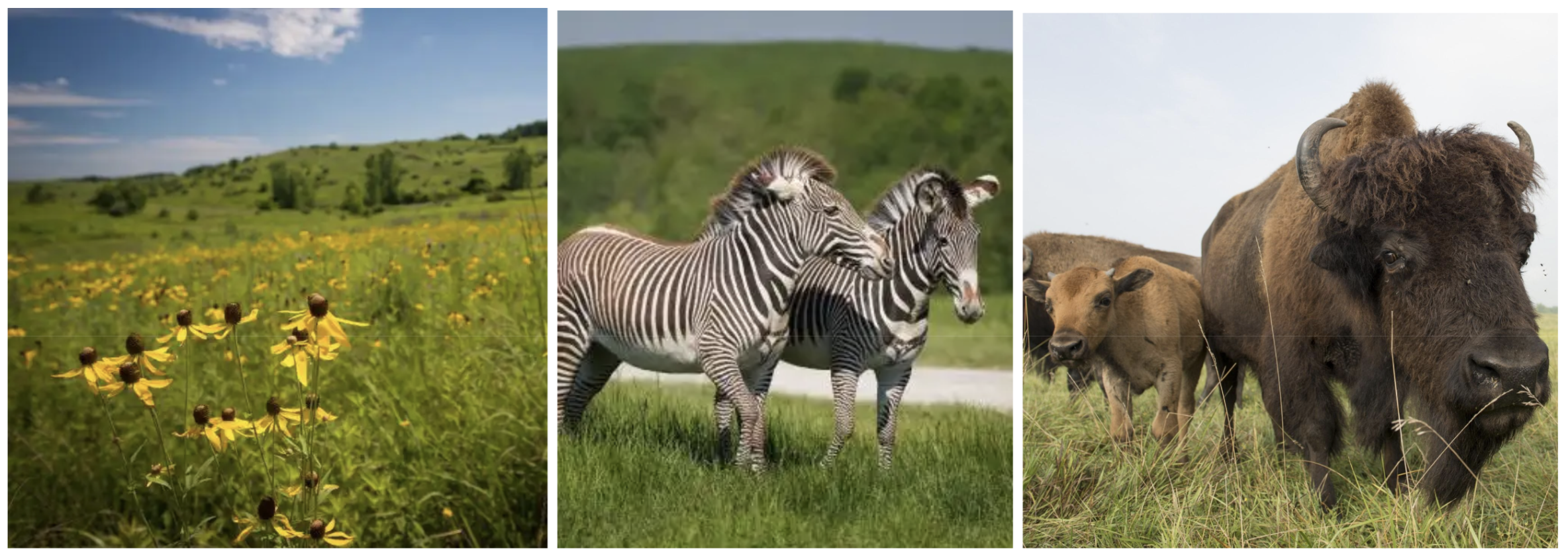 Photo Credit: The Wilds
Long-Term Vision: The Wilds Biological Research Field Station
We are developing The Wilds as a living laboratory for technology and nature research, supporting long-term transdisciplinary multimodal projects across diverse research areas:
Exotic Endangered Species Research
- Endangered ungulates, rhinos, and carnivores
- Behavior studies and individual identification
- Land-use pattern analysis
Conservation and Restoration Ecology
- Invasive species control and native biodiversity monitoring
- Habitat assessment and management
- Endangered prairie habitat protection
Digital Twin Development
Our work centers on developing a comprehensive digital twin of The Wilds — this 10,000-acre former strip mine in southeastern Ohio managed by the Columbus Zoo. This digital ecosystem will serve as a powerful tool for conservation planning, enabling researchers and wildlife managers to:
- Test conservation strategies in virtual environments before real-world implementation
- Optimize sensor deployment for maximum ecological insight with minimal animal disturbance
- Predict ecosystem responses to environmental changes and management decisions
- Train and validate AI models for biodiversity monitoring at scale
Multimodal AI for Biodiversity
Our research aims to advance the field of multimodal AI for environmental monitoring by creating datasets and models that can:
- Synthesize information across sensor modalities (visual, acoustic, GPS, satellite, environmental)
- Enable real-time adaptive sampling that responds to ecological events as they unfold
- Support autonomous ecosystem monitoring with minimal human intervention
- Scale conservation efforts through AI-assisted wildlife management
Impact Beyond The Wilds
This work establishes a replicable framework for digital twin development in conservation settings worldwide. Our open datasets and methodologies will enable:
- Global conservation applications across diverse ecosystems and species
- Training resources for the next generation of conservation AI models
- Collaborative research platform connecting ecology, computer science, and conservation communities
- Evidence-based conservation through data-driven decision making
Summer 2025 Proof-of-Concept
Project Scope
This summer represents our first step toward the digital twin vision. We’re conducting intensive fieldwork to collect a multimodal dataset focused on a 100-acre area used by Pere David’s deer and other species at The Wilds.
Study Area: Single pasture for proof-of-concept (View on Google Earth)
Timeline:
- Field Deployment 1: June 2025
- Field Deployment 2: August 2025
Sensor Network Deployment
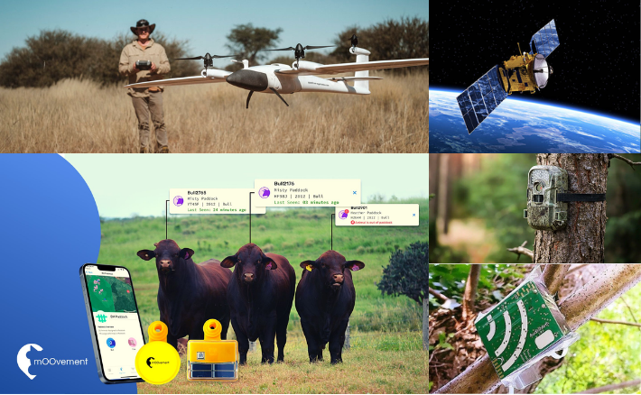
Senor network deployment. Clockwise: satellite, camera trap, AudioMoth bioacoustic monitor, GPS ear-tag Moovement Platform, and LiDAR-equipped fixed-wing drone.
| Sensor Type | Data Collected | Duration | Target Species | Specs |
|---|---|---|---|---|
| GPS Ear Tags | Hourly location + ID | Continuous | Pere David’s deer | Moovement Platform |
| Quadcopter Drones | Behavioral videos | 2-3 days, 4 hrs total | Zebras, giraffes, onagers, phorses, African wild dogs | Parrot Anafi, ModalAI Sentinal |
| Fixed-Wing Drones | Aerial photos + LiDAR | Single 2-hour session | Landscape + all species | LiDAR sensor |
| Camera Traps | Motion-triggered photos/video | 1 week continuous | All species (exotic + native) | Various models including GardePro |
| Bioacoustic Monitors | Continuous audio recording | 1 week continuous | Birds, insects, ungulate vocalizations | AudioMoth devices |
| Satellite Imagery | Landscape monitoring | Continuous archive | Vegetation + land use patterns | |
| Weather Station | Environmental conditions | Continuous | Context for all other data |
Key Research Questions
This summer’s fieldwork will specifically address:
- Sensor modality strengths: Which sensors are most effective for tracking land use, animal interactions, and individual identification?
- Spatial-temporal overlap: How well do different sensor types capture the same ecological events?
- Species identification: Can we reliably identify species through vocalizations alone?
- Behavioral patterns: How do animals use space differently throughout the day and season?
- Environmental influences: How do weather conditions affect animal behavior and sensor performance?
Technical Innovation
We’re testing the ICICLE cyber-infrastructure for autonomous monitoring, including:
- Autonomous drone navigation and adaptive flight planning
- Real-time camera trap image analysis and species detection
- Edge AI deployment for on-site data processing
- Sensor fusion techniques for multimodal data integration
Collaboration Opportunities
We invite collaborators to help shape this research and maximize its impact:
For AI/ML Researchers
- Access to unique multimodal training datasets with ground-truth labels
- Opportunities to develop novel sensor fusion approaches
- Testing ground for autonomous sampling algorithms
- Real-world validation of computer vision and bioacoustic models
For Ecologists & Conservation Biologists
- Biological research questions that can be explored with multimodal data
- Conservation applications of digital twin technology
- Habitat management insights from automated monitoring
- Species behavior analysis across multiple data streams
For Wildlife Managers
- Practical applications of digital twin technology for conservation planning
- Cost-effective monitoring strategies using autonomous sensor networks
- Evidence-based management through continuous ecosystem monitoring
- Scalable approaches for large-scale conservation efforts
What We Offer
- Dataset access for research and model development
- Co-authorship opportunities on resulting publications
- Collaborative research with interdisciplinary teams
- Student involvement in cutting-edge conservation technology
Get Involved
Ready to contribute to the future of conservation technology? We welcome:
- Research collaboration proposals and partnership ideas
- Biological research questions that could benefit from multimodal data
- Technical expertise in AI, robotics, and sensor networks
- Conservation applications and real-world deployment scenarios
Contact: Jenna Kline, kline.377@osu.edu
Website: NatureLab at The Wilds
Funding: ICICLE (NSF AI Institute for Intelligent Cyberinfrastructure) and Imageomics (NSF HDR Institute: Imageomics: A New Frontier of Biological Information Powered by Knowledge-Guided Machine Learning).
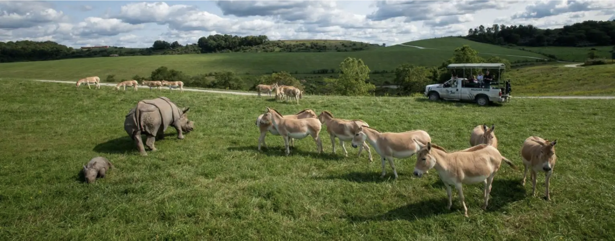 Photo Credit: The Wilds